One Ocean Expedition
Note
The codes used for this section are from an older version of wavy. It can be adapted with the newest version of the package, however you can still find the version used for this workshop on github.
The following examples are drawn from work where wavy was used related to the One Ocean Expedition.
1. Collocating satellite tracks with drifter
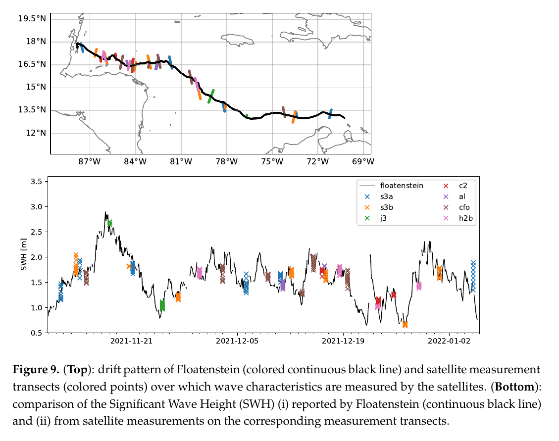
In Rabault et al. (2022) we compared a drifter (floatenstein) that can measure waves to satellite altimetry. To do something similar you need to obtain the following drifter time series as lists: - time as datetime objects - longitudes - latitudes
Those need to be formulated in a dictionary such that wavy can parse it.
>>> poi_dict = {'datetime':dt,'longitude':lons,'latitude':lats}
Now load the satellite class from wavy and hit play:
>>> from wavy.satmod import satellite_class as sc
>>> sco = sc(twin=30,distlim=50,mission='j3',region='global',poi=poi_dict)
After you can save the results as pickle or netcdf and make a figure as in Rabault et al. (2022).
2. Collocating model output with drifter
In a different experiment we compare Hs from a wave sensor onboard Statsraad Lemkuhl with the ecmwf wave model ecwam. Again we need from the instrument: - time as datetime objects - longitudes - latitudes - observations - and some name (nID)
Those need to be formulated in a dictionary such that wavy can parse it.
>>> poi_dict = {'time':dt,'longitude':lons,'latitude':lats,'obs':obs,'nID':'OneOcean'}
Import wavy’s collocation class add some collocation specifications and hit play:
>>> from wavy.collocmod import collocation_class as cc
>>> cco = cc(poi=poi_dict,model='ecwam_Hs',twin=30,date_incr=1,varalias='Hs',distlim=30)
Note
The observations may consist of missing values of the same length as the other parameters in case only a trajectory is of interest and not actual values from a drifter.